Storm expected to bring strong winds, rain, potential flooding to North Carolina
To prepare North Carolina for Hurricane Michael, Governor Roy Cooper today declared a State of Emergency and waived certain transportation rules. Forecasters expect the storm to bring strong wind and rain to North Carolina.
“I’m taking action to get North Carolina ready for Hurricane Michael, and I encourage people across our state to get ready as well,” Gov. Cooper said. “Make no mistake—Hurricane Michael is a dreadful storm, and it poses serious risks to North Carolina.”
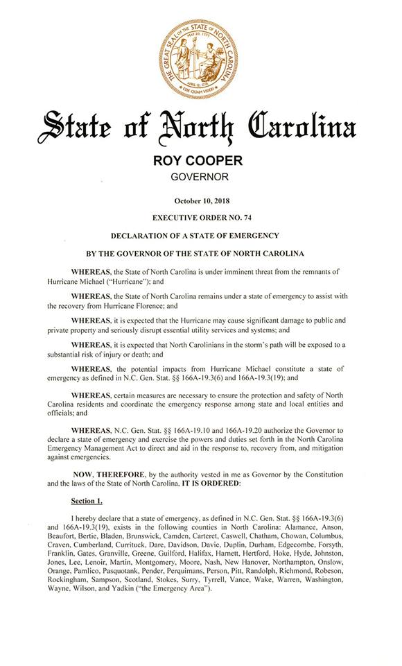
Gov. Cooper signed Executive Order No. 74, declaring a State of Emergency for 66 North Carolina counties. The order will be expanded to additional counties if needed. The State of Emergency authorizes the use of state resources to help local governments respond to the storm. It is also a first step in requesting federal or state assistance to individuals and homeowners if needed. In addition, it activates the state law against price gouging, or charging too much during a time of emergency.
Today, Gov. Cooper also signed Executive Order No. 75, temporarily waiving the cap on maximum hours of service restrictions for trucks and heavy vehicles traveling in and through North Carolina and size and weight restrictions for trucks. The order will help farmers harvest and transport their crops and livestock more quickly ahead of the storm. It can also help storm response vehicles and equipment moving into or through the state.
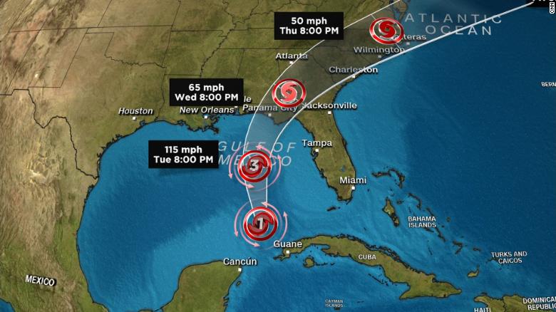
Hurricane Michael is expected to make landfall along the Florida panhandle today before curving across Georgia, South Carolina and North Carolina. A Tropical Storm Warning is in effect for six North Carolina counties: Brunswick, New Hanover, Pender, Bladen, Columbus and Robeson. A Tropical Storm Watch is in effect for several coastal, eastern and Sandhills counties. Tropical storm force winds will begin arriving in the state overnight tonight into early Thursday morning.
Parts of North Carolina still reeling from Hurricane Florence could see sustained tropical storm force winds from Michael. Winds will be strong enough to bring down trees weakened by Florence and to rip tarps from roofs of Florence-damaged homes.
Coastal areas can also expect storm surge and coastal flooding. Beaches already weakened by Florence’s towering surge may be especially vulnerable.
Rain will increase across the state today with the hardest rain expected Thursday and Thursday night. Rain will fall statewide, and as much as 7 inches of rain could fall in some areas of central North Carolina.
Heavy rain could cause flash flooding and river flooding. Gov. Cooper cautioned people who live in flood-prone areas to keep a close eye on the forecast and to be ready to evacuate if asked to.
Gov. Cooper said state emergency management officials are working with local and federal counterparts to prepare North Carolina for possible impacts from Michael. Gov. Cooper has activated 150 National Guard troops who will report for duty this afternoon. He also urged North Carolinians to take steps to prepare their families.
“The last thing people cleaning up from Florence need right now is more wind and rain. But this storm is coming, and we will be ready for it,” Gov. Cooper said.
NC Emergency Management shared the following tips for preparing for the storm:
- Build or restock your emergency supply kit.
- Make a family communications plan.
- Follow weather reports closely.
- Know the routes to leave your home if you’re asked to evacuate.
- If authorities ask you to leave, do so quickly.
Additional storm safety tips can be found on the free ReadyNC mobile app or online at readync.org.

